Hike #1416
August 14, 2019
Bridge to Nowhere
Hike Leader: Alice Weiss
Meet at 9:00 am for start at 9:30 am
Please print your own hike descriptions and maps. This will avoid the inconvenience and save costs to the hike leader.
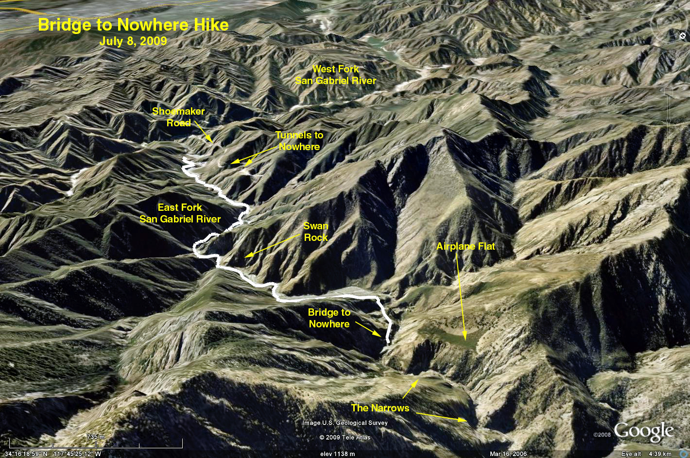
Trailhead Directions: Take the I-210 Freeway to the Azusa off ramp. Turn left (north), Azusa Avenue will become San Gabriel Canyon Road and is also SR 39. Follow it up the mountain to the East Fork Bridge. Turn right onto the bridge, and continue past Williams Camp. It becomes a little tricky when you come to the intersection of the Glendora Mountain Road. Turn right and immediately turn left crossing the Glendora Road. Do not turn onto Glendora Mountain Road. Continue to a white bridge and cross it, go up to the end of the road and park in the parking lot. There is a pit toilet there.
The Hike: Hike past the locked gate to Heaton Flat. At Heaton Flat cross the river for the first of many crossings. Continue up-river past Swan Rock to the Narrows. The last 1.25 miles to the bridge is unshaded without the benefit of the cooling stream . Have lunch on the bridge and return to the cars. Be prepared to make many stream crossings. HINT: The road that used to go to the bridge was on the east side. You can often find portions of a trail over there which cuts down on the number of crossings. On #1416 we did approximately 12 crossings upstream but approximately 6 downstream by making better use of the east trail/road. Water level obviously depends on the season. On #1416, water level was at knee level or less. Pace is slowed by number of crossings. #1416 took 6 hours and 20 mintes including 20 minutes lunch at bridge.
GPS:
Approximately 10.4 miles RT
Elevation gain 1150 feet
Google Earth photo - Bridge to Nowhere
2019-08-16