Distance: 8 miles RT
Elevation gain: 1300 ft.
Directions to Trailhead: Take the 118 Freeway to Topanga Canyon Blvd., make a right turn off the freeway and then left onto Poema Place. Valley hikers make a left onto Poema Place from the end of Topanga Canyon Blvd. Drive up Poema Place to the entrance of Indian Wells residential area. Park on the street east of the double yellow street line. (The yellow center line portion of the road is private property and parking on this portion of the road is prohibited). No restroom facilities are available.
The Hike: Enter the residential area on the left side of the entrance gate. Follow the green line painted on the left side of road until you reach a stop sign. Cross the street at the green painted crosswalk and follow the green line up the hill (Macoda Lane) and onto the entrance of the trail (do not follow green line that goes to the left at this point since it is coming from the other entrance). The green line marks the route for hikers to traverse this gated community, an easment that was required from the builder in order to complete the development. It is about 1 mile from the gate to the trail entrance.
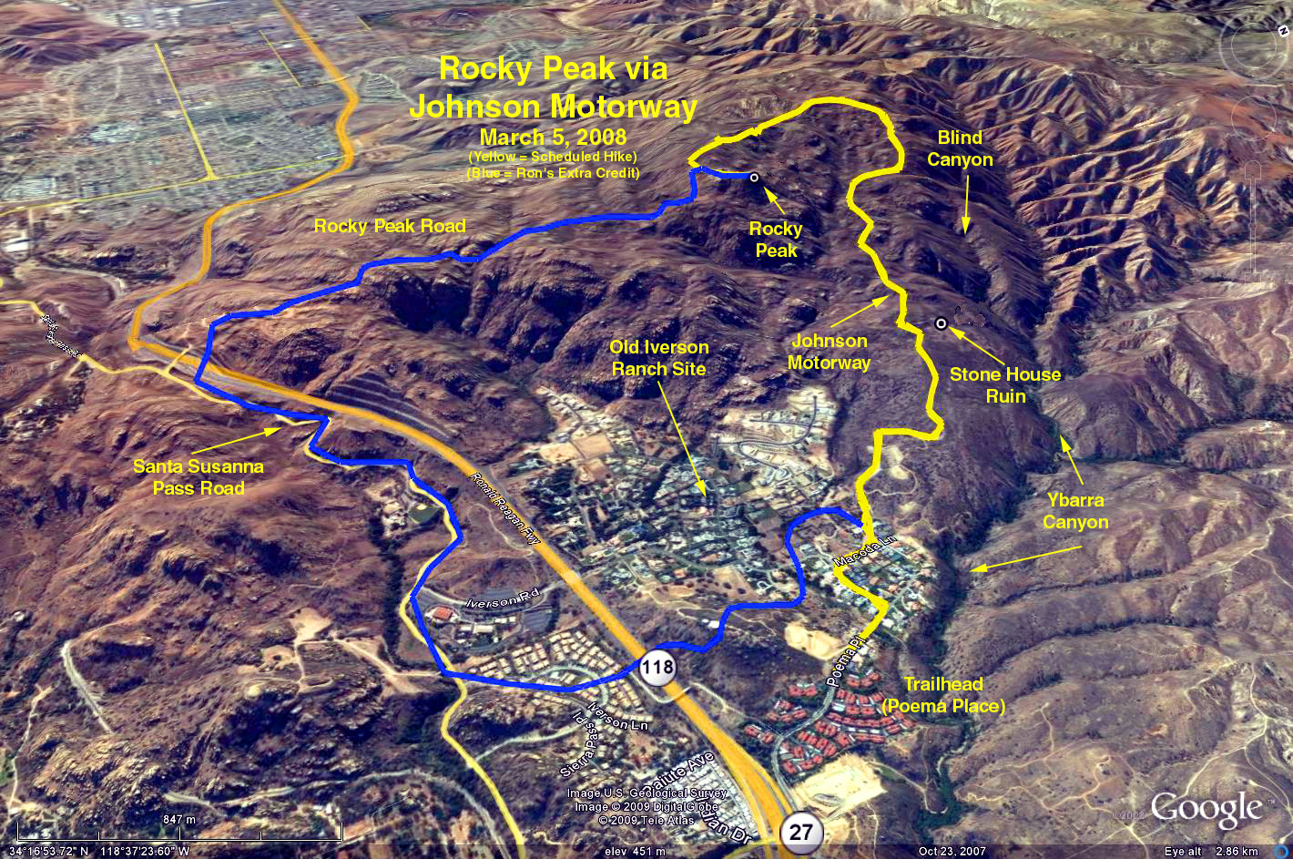
Once on the trail keep left and continue upwards on a degraded road. At 2.1 miles you will reach Rocky Peak Road, turn right and continue up to the peak.
For those wanting a shorter hike, hike along Rocky Peak Road as far as you want and return the way you came.
For those wanting a more demanding hike, make a loop by returning from the peak all the way down Rocky Peak Road, over the 118 freeway, and then back via Santa Susanna Pass Road and neighborhood streets to the trailhead.
Google Earth Photo - Rocky Peak via Johnson Motorway
GPS Data:
To the peak and return: 7.6 mi. RT, elevation gain = 1300 ft.
The loop: 10 mi. RT, elevation gain = 1300 Ft.