Distance: 7 miles round trip.
Elevation gain = 600 ft.
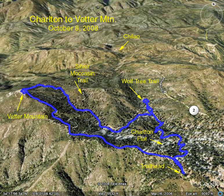
Directions to Trailhead: Drive up Angeles Crest Highway to mileage paddle 47.54, then turn left on the Charlton Flat Road, and turn left to the campground and picnic tables.
The hike goes to the Vetter Lookout along the road and returns along the trail. On the way back we will visit the Wolf Tree Interpretive Trail. The speedsters can bag Devil's Peak and Mt. Mooney.
An excellent map is available on the Chilao Visitor Center Brochure, which may be downloaded from: http://www.fs.fed.us/r5/angeles/maps/brochures/chilao.pdf
Also check these Tom Harrison maps (less detailed): "Mt. Wilson Trail Map" and "Angeles Front Country"
Google Earth photo - Vetter Lookout from Charlton Flat Trailhead
GPS Data:
RT = 7.3 mi.
Max Elevation change = 600 ft.