Hike #1402
May 8, 2019
Stoddard Peak
Hike Leader: Ron Forbess
Meet at 9:00 am for start at 9:30 am
Please print your own hike descriptions and maps. This will avoid the inconvenience and save costs to the hike leader.
Distance: 6.0 miles RT
Elevation gain: 1100 ft.
Directions to Trailhead: Take the 210 Freeway and exit at Baseline Road. Turn left on Baseline, and within 1 block turn right on Padua Avenue. In 1.7 miles turn right on Mt. Baldy Road (stop sign). Proceed on Mt. Baldy Road to mile marker 1.1 and look for a sign on the right marking "Barrett-Stoddard" Road. Turn right and park in the parking lot.
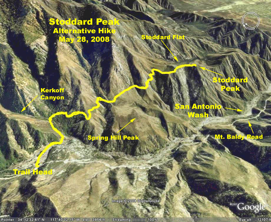
Summary: The hike to the top involves mostly road-walking, with a short, rugged stretch near the peak itself.
The Hike: We start hiking at the intersection of the dead-end Mountain Avenue. Don't take the old, paved, canyon-bottom road to the south, but rather head east on the dirt road that descends past a small hydro-power plant. Cross San Antonio Canyon's stream and continue curving south, then east on the dirt road as it contours into Barrett Canyon. After 0.55 miles we come to a fork in the road ... take the left fork that continues the uphill climb. After passing some picturesque cabins and yapping dogs, we arrive at a locked vehicle gate which we bypass and continue following the road. After curling around steep Cascade Canyon, we climb to a broad saddle (2.6 miles), where the road begins to descend lrft into the Stoddard Canyon drainage.
From the saddle, a faint use-trail (leads off to the right) steeply west up through tall brush to the first false summit. The trail then turns south along the top of a sunny ridge. We proceed 0.4 mile on this path, passing over another false summit, to the true summit of Stoddard Peak as marked on the Mt. Baldy topo map. The second false summit is actually slightly higher than Stoddard Peak (contrary to the contour lines as printed on the topo map). After lunch at the top, we return the way we came.
Google Earth Photo - Stoddard Peak
2019-05-08