Hike #1314
Mt. Waterman from Buckhorn
April 12, 2017
Ron Obert, Hike Leader
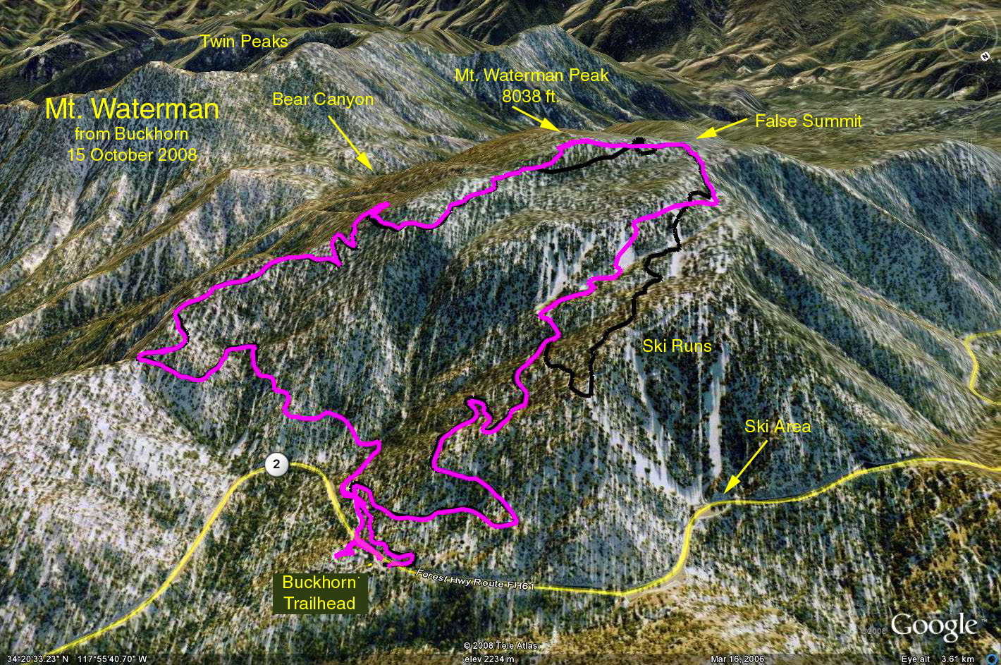
Summary: The hike is along the nice but thinly forested high country of the Angeles National Forest. The basic hike is an out and back to the rocky ridge that forms the summit of Mt. Waterman at 8,038 feet. An alternate version allows completing a loop by returning down the dirt road that is part of the Mt. Waterman ski area.
Directions to Trailhead: Leave the 210 freeway at Highway 2, the Angeles Crest Highway. Continue up the Angeles Crest Highway until mile marker 58.02, the Buckhorn day use area. Turn left and park. There is a restroom adjacent to the parking/picnic area. Use your Golden Age Passport for parking.
Hike: Begin the hike by exiting the parking area, crossing Hwy. 2 and continuing on the dirt road beyond (which will be the return path for those who complete the loop version). After about a quarter of a mile the trail crosses the dirt road. Turn left and continue up the trail. In a little less than 2 miles there will be a first look down at the Los Angeles basin. A bit further, a junction with the trail that leads to Twin Peaks will be reached. Only real tigers should choose to go toward Twin Peaks. As the ridge like summit of Mt. Waterman is approached, there are trail choices and the higher choices will get you to the boulder outcroppings that form the summit. Returning as you came will result in a 6.7 mile hike with a gain of 1200 feet.
Those wishing to complete the 7.0 mile loop should continue west along the crest and drop down a bit to find the ski areas upper dirt road. Follow the dirt road down through the ski area to the crossing of the trail near the trailhead.
A map will be supplied on hike day.
Distance: RT 6.7 miles
Elevation Gain: 1,200 ft.
2017-04-13